LATEST
K2 Summer Expeditions 2026 — Now Accepting Bookings New Trek Added: Batura Glacier — Gilgit Zone Government Verified & Registered Agency · Skardu, GB 24/7 Customer Support · WhatsApp: +92 341 153 7783 Best Price Guarantee on All Packages Winter K2 Expedition Season · December – February K2 Summer Expeditions 2026 — Now Accepting Bookings New Trek Added: Batura Glacier — Gilgit Zone Government Verified & Registered Agency · Skardu, GB 24/7 Customer Support · WhatsApp: +92 341 153 7783 Best Price Guarantee on All Packages Winter K2 Expedition Season · December – February

Author name: Khadim Hussain

Expedition

Where Is Lady Finger Peak Located?

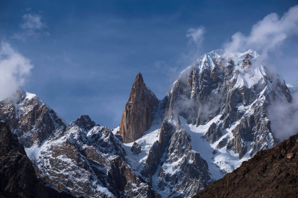
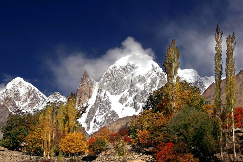
Lady Finger Peak is located in the Hunza Valley of Gilgit-Baltistan, Pakistan. Also called Ladyfinger Peak, Bublimotin or Bublimating, it is a sharp granite spire on the southwest ridge of the Ultar Sar massif, in the Batura Muztagh of the Karakoram. The tower rises directly above Karimabad, close enough that you can see it from the village, from Baltit Fort, and from viewpoints along the valley. That is the straightforward answer most people are looking for. The rest of this article explains the local names, the height, the neighbouring peaks on the same skyline, and the difference between visiting Hunza to see the mountain and coming to climb it. Lady Finger Peak is located in Hunza Valley, Pakistan If you type “Lady Finger Peak is located in” into a search, the place you want is Hunza, in the north of Pakistan, in the region of Gilgit-Baltistan. The mountain stands above Karimabad, the historic heart of the valley, on the steep wall of peaks that includes Hunza Peak and Ultar Sar. It is not in Skardu, not on the Baltoro Glacier, and not in the same immediate neighbourhood as K2. It belongs to the western Karakoram, above a settled valley of terraces, orchards and forts. Because the peak is so visible, it has become one of the signature shapes of Hunza. Travellers photograph it at sunset, when the granite takes on a warm colour, and often assume it is higher than it is, or confuse it with the snowier summit beside it. The location is simple; the skyline takes a little longer to read. Local names and the view from Karimabad The English name Ladyfinger, or Lady Finger Peak, describes the slender, almost finger-like profile of the spire. Locally and in climbing literature the mountain is also known as Bublimotin, Bubli Motin or Bublimating. All of these names refer to the same tower. You do not need to be a climber to see it. From Karimabad, from Baltit Fort, and from higher viewpoints such as Duikar (Eagle’s Nest), the spire stands out because it is relatively snow-free compared with the peaks around it. The best-known companion on that view is Hunza Peak, the 6,270-metre snow summit immediately beside the needle. Behind them rises Ultar Sar at 7,388 metres. Once you can separate those three shapes, the photograph in front of you becomes easier to name, and you are less likely to plan the wrong climb. How high is Ladyfinger Peak? Ladyfinger Peak is about 6,000 metres high (19,685 feet). Some surveys list the summit at 5,993 metres. Either way, it is a 6,000-metre-class rock spire, not an 8,000-metre expedition peak. What makes it striking is not raw height but shape. The tower has little prominence above the col it shares with Hunza Peak, so from the valley it looks like a thin blade rather than a bulky mountain. That is also why a short approach from Karimabad should not be mistaken for an easy summit. First ascent and the nature of the climb The peak was first climbed on 22 May 1982 by a French team that included Patrick Cordier and Jacques Maurin. The ascent, and the routes repeated since, are serious high-altitude rock climbs, not ridge walks from the meadow. A modern Ladyfinger Peak expedition is a technical objective: steep granite, a glacier or couloir approach, and, on some lines, the gear and patience of big-wall climbing, including haul bags and living on the face. This is worth stating plainly because the search that brings people here is often informational — they want to know where the mountain is — while the expedition page is for a much smaller group of experienced alpine and big-wall climbers. Both uses of the name are legitimate. They should not be mixed up. Visiting Hunza versus climbing the peak If you want to see where Lady Finger Peak is located, you travel to Hunza. The mountain is part of the everyday view from Karimabad, and a visit to Baltit Fort or a sunset at a valley viewpoint is enough to find it. No climbing permit and no technical skill are required to look at the spire, photograph it, or walk the village paths beneath it. If you want to climb it, the approach is still short — typically a day’s steep walk from Karimabad up the Ultar gorge to Ultar Meadow — but the wall above camp is another matter. The route is reserved for experienced teams who already climb steep rock and mixed ground at altitude. A supported trip with Skardu Expedition is built around that reality: time in Karimabad, a brief approach, and a long enough climbing period to work the wall in good conditions, usually between June and August. The mountain has often been treated as an open-area objective below the height at which special expedition permits are required, but rules can change. Anyone coming to climb, rather than to visit the valley, should confirm the latest paperwork before travel. Ladyfinger Peak and Hunza Peak The two summits share a ridge and a base-camp area, and they are often mentioned together. They are not the same climb. Hunza Peak is the higher, snowier mountain and a technical alpine route of rock, ice and mixed ground. Ladyfinger is the slender rock spire. If you are choosing an objective, start with the shape you can see from the valley, then read the route, not only the shared location. More detail on a climbing trip is on the Ladyfinger Peak (Bublimotin) expedition page. Frequently asked questions Where is Lady Finger Peak located? Lady Finger Peak is located in the Hunza Valley, Gilgit-Baltistan, Pakistan, directly above Karimabad. It stands on the southwest ridge of the Ultar Sar massif in the Batura Muztagh of the Karakoram. What is the local name of Lady Finger Peak? It is also known as Bublimotin, Bubli Motin or Bublimating. These names all refer to the same granite spire. How high is Ladyfinger Peak? The peak is about 6,000 metres
Expedition

Hunza Peak: Height, Location and Climb

Hunza Peak is the elegant snow summit that stands directly above Karimabad, in the Hunza Valley of Gilgit-Baltistan, Pakistan. At 6,270 metres, it is lower than the 8,000-metre giants of the Baltoro, yet it is not a trekking peak. It is a technical alpine climb of granite, ice and mixed ground, set on the southwest ridge of the Ultar Sar massif, in the Batura Muztagh — the western end of the Karakoram. The mountain is famous in part because so many people have already seen it without knowing its name. From Baltit Fort, from the terraces of Karimabad, and from stretches of the Karakoram Highway, the same skyline appears: a slender rock needle, a snowier summit beside it, and a higher massif behind. The needle is Ladyfinger Peak. The snowier summit is Hunza Peak. The higher massif is Ultar Sar. Sorting out that view is the starting point for anyone searching the name. Where is Hunza Peak? Hunza Peak is located in the Hunza Valley, Gilgit-Baltistan, Pakistan, immediately above Karimabad. It belongs to the Batura Muztagh and sits on the southwest ridge of the Ultar Sar group, the most southeasterly of the major clusters in that subrange. The whole massif rises steeply from the valley floor, which is why the peak looks so close from the village and why the approach, by Karakoram standards, is unusually short. That closeness is geographical, not logistical ease in the climbing sense. You can be in Karimabad one morning and walking up the Ultar gorge the next, but the ground above base camp is steep, exposed and technical. A Hunza Peak expedition is a compact alpine trip, not a long glacier walk followed by a moderate snow climb. Height and the Ultar Sar skyline Hunza Peak is 6,270 metres (20,570 feet) high. It has more than one snowy top of roughly similar height, a detail that matters mainly to climbers comparing historic lines, but the figure used throughout modern expedition descriptions is 6,270 metres. Ladyfinger Peak, also called Bublimotin, stands nearby at about 6,000 metres and has little prominence above the col it shares with Hunza Peak, which is why it looks so thin from below. Ultar Sar, the parent massif, rises to 7,388 metres. From the valley, the three can blur into a single wall of rock and ice. Once you know the shapes, they separate cleanly: Ladyfinger is the sharp, relatively snow-free spire; Hunza Peak is the snow summit beside it; Ultar Sar is the larger mountain behind. This is also why photographs labelled “Hunza Peak” sometimes show the wrong summit. If you are planning a climb, it is worth being exact about which top you mean. A short approach, a serious climb Most teams reach Hunza by flying or driving from Islamabad to Gilgit, then continuing along the Karakoram Highway to Karimabad. From the village, the trek up the Ultar Nala to the pastures and on to base camp at around 4,000 metres usually takes one to two days. Compared with the week-long walk to the Baltoro 8,000ers, that approach is brief. It can also be steep, hot in the gorge, and exposed to objective hazard as you near the glacier. The climbing itself is the main event. Routes involve couloirs, granite and mixed ground, and sharp snow or ice ridges, with grades in the serious alpine range rather than a simple snow plod. This is a peak for climbers who already move well on rock and ice at altitude, not for trekkers who want a high viewpoint. The short walk-in simply means more of the trip is spent on the mountain rather than on the approach. First ascent and the character of the mountain Hunza Peak was first climbed in 1991. The best-known of those early ascents is the alpine-style climb of the southwest ridge by Mick Fowler and Caradog Jones, who reached the col between Hunza Peak and Bublimotin from the Hasanabad side and then followed the ridge to the top. A later ascent in 2009 climbed toward the col from the east and joined the southwest ridge below the summit. The mountain has seen only a small number of ascents compared with more popular 6,000-metre objectives, which is part of its character: it is visible to everyone in the valley and climbed by relatively few. Hunza Peak, Ladyfinger or Ultar Sar? If your interest is a photograph from Karimabad or a walk to a viewpoint such as Duikar, you do not need to climb any of these peaks. The skyline is the attraction, and it is available from the valley. If your interest is a technical climb on the same ridge, you need to choose the objective carefully. Ladyfinger Peak is a sharp rock spire and a high-altitude big-wall problem. Ultar Sar is a much higher and more complex mountain. Hunza Peak sits between them in height and, for many alpine teams, in ambition: a serious 6,270-metre climb with a short approach and a memorable position above a living cultural landscape. A supported Hunza Peak expedition is built around that choice: time in Karimabad, a short trek to base camp, and a climbing period long enough to fix the route, acclimatize and wait for a safe weather window. Planning a trip to the Hunza Valley The usual climbing season is summer, typically June to August, when conditions on the rock and ice are most workable. Mountain flights between Islamabad and Gilgit are weather-dependent, so any sound itinerary includes an overland option on the Karakoram Highway, with overnight stops if needed. Skardu Expedition can arrange transport, staff, base-camp support and current advice on paperwork. Hunza Peak lies below 6,500 metres and has often been treated as an open-area objective, but regulations can change, and teams should confirm the latest requirements before travel. Frequently asked questions How high is Hunza Peak? Hunza Peak is 6,270 metres (20,570 feet) high. It is the snowier summit beside Ladyfinger Peak, on the southwest ridge of the Ultar Sar massif. Where is Hunza

Mountaineering

Snow Lake Pakistan: Location, Height, Trek

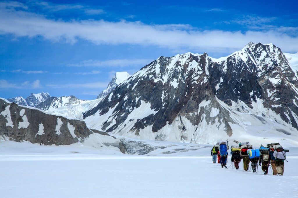
Snow Lake Pakistan is one of the most searched — and most misunderstood — places in the Karakoram. Despite the name, it is not a lake of open water. It is a vast high basin of snow and ice in Gilgit-Baltistan, known locally as Lukpe Lawo, sitting where the upper Biafo and Hispar glaciers meet. People come here on a long glacier traverse, not to walk a shoreline or take a boat. That distinction is the key to planning a trip. A visit to Snow Lake is a serious, multi-day alpine trek across crevassed ice, with a high pass of about 5,150 metres and nights spent in a self-contained camp. There are no teahouses on the glacier. If you understand that from the start, the journey becomes one of the great walks in Pakistan rather than a disappointment for anyone expecting a blue alpine lake. Where is Snow Lake Pakistan? Snow Lake Pakistan lies in the central Karakoram, in Gilgit-Baltistan. The basin sits at the head of the Biafo Glacier, which is reached from Askole, the last roadhead beyond Skardu in Baltistan, and at the head of the Hispar Glacier, which drains toward Hispar village, Nagar and the Hunza Valley. In other words, it stands on a high ice divide between two historic mountain regions. The usual way to see it is the Biafo–Hispar traverse: start in Skardu, drive to Askole, walk up the Biafo to the basin, cross Hispar La, and descend to Hispar and Karimabad. The trek can also be walked in the other direction, from Hunza toward Baltistan, but most parties prefer to start from Askole because the long rise up the Biafo gives a more gradual acclimatization. Why it is not a lake Martin Conway described the basin in 1892, and the English name Snow Lake has been used ever since. Locally it is Lukpe Lawo, a high snow field rather than a body of water. There is no shore, no reflection in summer meltwater of the kind you find at lower lakes, and no settlement beside it. What you see is a wide, almost level expanse of névé — compacted snow feeding the glaciers — ringed by granite peaks. That is also why photographs can confuse first-time visitors. The whiteness looks like a frozen lake from a distance, especially from Hispar La. Underfoot, it is glacier travel: hidden crevasses, bright snow, and the need to rope up, particularly later in the morning when the surface softens. Height, size and the two glaciers Snow Lake sits at about 4,800 to 4,900 metres; a commonly cited figure is 4,877 metres (16,000 feet). The basin is roughly 16 kilometres across. The Biafo Glacier is about 67 kilometres long, and the Hispar Glacier about 49 kilometres. Together they form one of the longest continuous glacier systems outside the polar regions, which is the real significance of the place. Around the basin rise some of the most impressive granite walls in the Karakoram, including the Ogre (Baintha Brakk) and the Latok group. The trek is not a climbing expedition, but the architecture of those peaks is a large part of why the crossing stays in the memory. How the Biafo–Hispar traverse works A typical Snow Lake Pakistan itinerary lasts well over two weeks, including travel between Islamabad, Skardu and the roadheads. After Askole, the first days follow the Biafo moraine through camps such as Namla, Mango and Baintha. Baintha, a green meadow at about 4,000 metres, is usually used as an acclimatization stop before the route moves onto continuous snow. Beyond Baintha, trekkers step onto the white upper glacier and move toward the Sim Gang junction and then into the Snow Lake basin itself. A high camp is often placed below Hispar La. The pass, at about 5,150 metres, is the high point of the trek and the moment when the view back across the basin is at its widest. The descent follows the Hispar Glacier, which is more broken and laborious than the Biafo, down to Hispar village and then by jeep to Karimabad in the Hunza Valley. Skardu Expedition runs this traverse as a fully supported trek, with a licensed guide, porters, camping equipment and the permits required for a restricted route through Central Karakoram National Park. How hard is the trek? The crossing is strenuous, and on the upper snow it is more isolated than the standard walk to K2 Base Camp. You do not need to be a technical climber, but you do need to be comfortable walking for many hours on uneven glacier, using crampons and an ice axe, and travelling on a rope where the snow is crevassed. The Hispar side, with its side glaciers and moraine, is often the more tiring half. Compared with a K2 Base Camp trek, the Snow Lake trek spends more time on open ice and less time on a well-used moraine highway. The reward is the scale of the basin and the feeling of crossing from Baltistan into Hunza on a river of ice. The cost of that reward is self-sufficiency: everything you need must be carried in, and there is no simple retreat once you are high on the glacier. Permits and practical planning Foreign trekkers need a trekking visa or the correct restricted-area paperwork, an official permit, and a licensed guide through a registered operator. The usual season is late June to mid-August, when the glaciers are in their most workable summer condition. Weather still decides everything: fresh snow can hide crevasses, and storms can pin a team in camp. A well-built itinerary includes rest and buffer days rather than a tight dash for the pass. Frequently asked questions Where exactly is Snow Lake in Pakistan? Snow Lake, or Lukpe Lawo, is in the Karakoram of Gilgit-Baltistan, at the meeting of the Biafo and Hispar glaciers, between Askole in Baltistan and Hispar in Nagar, on the way to the Hunza Valley. How high is Snow Lake? The basin lies at about 4,800 to 4,900 metres,

Expedition

Spantik (Golden Peak): Height and Climb

Spantik, also known as Golden Peak, is one of the best-known 7,000-metre mountains in Pakistan. It stands in the Spantik-Sosbun mountains of the Karakoram, in Gilgit-Baltistan, and has a rare combination: a relatively moderate normal route on one side, and a famous, extremely difficult wall on the other. For many climbers, that is why a first serious high-altitude expedition in the Karakoram begins here. The mountain is high enough to teach the rhythms of a long expedition — travel to Skardu, a glacier approach, high camps, and a summit day in thin air — without the technical severity of Masherbrum, Rakaposhi’s hardest lines, or the 8,000-metre peaks of the Baltoro. Understanding both faces of the mountain helps you decide whether Spantik is the right next step. Where is Spantik? Spantik rises in Gilgit-Baltistan, between the Shigar side of the range and the Nagar valleys. The usual expedition approach comes from Skardu, through the Shigar and Basha valleys, to the village of Arandu at the foot of the Chogo Lungma Glacier. From there, teams trek the moraine to base camp. The mountain can also be reached from the Nagar and Hopar side, though most commercially supported climbs use the Arandu approach. From high on the ridge, the views take in neighbouring giants such as Diran and the wider western Karakoram. The peak is not on the Baltoro, and that is part of its appeal: you can attempt a genuine 7,000-metre summit without joining the busier trail toward Concordia. Height and the name Golden Peak Spantik is 7,027 metres (23,054 feet) high. The name Golden Peak comes from the warm colour the mountain takes in late light, and especially from the great cream-yellow marble wall on the northwest face, known as the Golden Pillar. In Burushaski the mountain has been called Ghenish Chhish, with the same golden meaning. In climbing literature you will also see the Balti name Spantik used for the standard expedition peak. The first recorded attempt was in 1906, when Fanny Bullock Workman and William Hunter Workman reached high on the mountain but did not summit. The first ascent followed in 1955, when a German team climbed the peak from the Chogo Lungma Glacier. That same general approach — Arandu, the glacier, and the long snow ridge — remains the normal way up today. The normal route: a classic first 7,000er The standard route is a long snow ridge rather than a steep technical climb. Slopes are often in the mid-30s, with some sections around 40 to 45 degrees, and the work is mostly glacier travel, cramponing, and steady movement at altitude. That profile is why Spantik is so often recommended as a first 7,000-metre peak, and as a training mountain for climbers who hope to move on to 8,000-metre expeditions. It is still a real climb. The ridge is long, the air is thin, and weather can close in quickly. Teams typically spend many days on acclimatization rotations between base camp and higher camps before a summit push. Fitness, patience, and sound crampon and self-arrest skills matter more here than advanced rock climbing. A supported Spantik expedition is designed around that rhythm: logistics to base camp, a structured climbing period, and enough time to wait for a clean weather window. The Golden Pillar is a different mountain The northwest face is not the route described above. The Golden Pillar is a huge alpine wall of marble and granite, first climbed by Mick Fowler and Victor Saunders in 1987. It is one of the celebrated hard routes of the Karakoram, and it has little in common with the normal snow ridge. If you book a standard expedition, you are coming for the ridge, not for the Pillar. Confusing the two is the most common misunderstanding in a search for Spantik. The approach from Arandu After arriving in Islamabad, climbers fly or drive to Skardu, complete packing and permit formalities, then travel by jeep to Arandu. The trek to base camp follows the lateral moraine of the Chogo Lungma Glacier and usually takes a couple of days, with an intermediate camp on the way. Base camp is often placed on a grassy moraine around 4,300 metres, below the climbing ridge. The best season is generally late June through August, when the approach is in better condition and the ridge is more reasonably in shape. Skardu Expedition handles the road travel, porters, kitchen staff and base-camp setup so that the climbing team can concentrate on rotations and the summit period. Who should climb Spantik? Spantik suits mountaineers who already move comfortably on glaciers and have experience at 5,000 or 6,000 metres, whether in Pakistan or elsewhere. It is a poor choice as a first-ever mountain trip, and it is the wrong peak if your goal is a hard technical wall. It is an excellent choice if you want to learn how a 7,000-metre expedition feels — the length of the days, the need to acclimatize, and the discipline of turning around when the weather is wrong — before you commit to a larger objective. If that is your aim, a Spantik expedition from the Arandu side is one of the most logical starting points in the Karakoram. Frequently asked questions How high is Spantik? Spantik is 7,027 metres (23,054 feet) high. It is also known as Golden Peak. How difficult is the normal route? The standard ridge is a moderate high-altitude snow climb, not a hard technical face. The main challenges are length, altitude, weather and glacier travel. The Golden Pillar on the northwest face is a separate, much harder route. When is the best time to climb Spantik? Late June through August is the usual season. The exact summit window in any year depends on conditions on the ridge and the weather. Do you need previous expedition experience? Yes. Climbers should already have high-altitude trekking or mountaineering experience, ideally on 5,000- to 6,000-metre peaks, and should be comfortable in crampons on glaciated terrain.

Expedition

Gasherbrum I vs II: Height, Routes, History

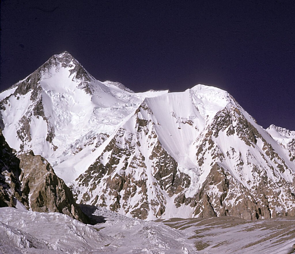
Gasherbrum is not one mountain. It is a tight cluster of high peaks at the head of the Baltoro Glacier, in the Karakoram of Gilgit-Baltistan, on the Pakistan–China border. The name comes from Balti words usually translated as a beautiful or splendid mountain, and the group includes two 8,000-metre summits — Gasherbrum I and Gasherbrum II — plus several slightly lower neighbours that still rank among the great walls of the range. If you are comparing the two 8,000ers, the distinction matters. Gasherbrum I, also called Hidden Peak, is higher, less frequently climbed, and more technically serious. Gasherbrum II is a little lower and generally regarded as the more approachable of the pair, which is why it is often chosen as a first 8,000-metre peak. Both are reached by the same long walk up the Baltoro, and both are supported from the same corner of the South Gasherbrum Glacier. The peaks of the Gasherbrum massif The massif is usually counted as six main summits. The two that draw organised expeditions are the 8,000-metre peaks: Gasherbrum I (Hidden Peak, also surveyed as K5): 8,080 metres, 11th-highest mountain in the world, and the third-highest in Pakistan after K2 and Nanga Parbat. Gasherbrum II: 8,035 metres, 13th-highest in the world, and a frequent first 8,000-metre objective in the Karakoram. Beside them stand Gasherbrum III and the striking Gasherbrum IV, whose west face — the so-called Shining Wall — is one of the most famous rock and ice faces in the range. Gasherbrum IV was first climbed in 1958 by Walter Bonatti and Carlo Mauri. The lower Gasherbrum V and VI complete the group. For most visitors, though, a search for Gasherbrum still leads first to Hidden Peak and its slightly lower twin. Gasherbrum I, the Hidden Peak Gasherbrum I earned its English name in 1892, when William Martin Conway’s expedition noted that the summit stays concealed behind nearer ridges for much of the approach along the Baltoro. Even from Concordia, where K2, Broad Peak and the Gasherbrum wall fill the sky, Hidden Peak can remain out of view until the route turns up the South Gasherbrum Glacier. The first ascent was made on 5 July 1958 by Americans Pete Schoening and Andrew Kauffman, on an expedition led by Nicholas Clinch. It was a landmark climb on what was then the last unclimbed 8,000-metre peak in the Karakoram. Later history added two other chapters that still shape the mountain’s reputation: in 1975 Reinhold Messner and Peter Habeler climbed a new line in alpine style, and on 9 March 2012 Adam Bielecki and Janusz Gołąb made the first winter ascent. A modern Gasherbrum I expedition is still a serious undertaking. The upper mountain involves steep glaciated terrain and mixed rock-and-ice climbing at high altitude. It is a step above Gasherbrum II in difficulty, and it is not the mountain to choose simply because the two peaks share a base-camp area. Gasherbrum II, the more frequented 8,000er Gasherbrum II stands 45 metres lower than its neighbour, at 8,035 metres. It was first climbed on 7 July 1956 by an Austrian team: Fritz Moravec, Josef Larch and Hans Willenpart. Over the following decades it has attracted more traffic than Hidden Peak, in part because the standard route is widely considered less technically demanding, and in part because a successful climb here can serve as a first 8,000-metre experience before a later attempt on a harder Karakoram giant. That reputation should not be read as easy. Any 8,000-metre climb involves the death zone, avalanche terrain, long summit days and the same narrow weather windows that govern the Baltoro. Gasherbrum II is the more approachable of the two 8,000ers in the massif; it is not a trekking peak. How expeditions reach the Gasherbrum peaks Almost every team follows the same corridor. After arriving in Islamabad, climbers fly or drive to Skardu, then travel by jeep through the Shigar Valley to Askole, the last village before the glacier. From Askole the approach is on foot up the Baltoro, through camps such as Paiju, Urdukas and Goro, to Concordia — the great junction often called the throne room of the Karakoram. From there the route leaves the main highway of ice and climbs toward the South Gasherbrum Glacier, where base camps for both 8,000ers are placed. Skardu Expedition is based in Skardu and supports this approach with permits, transport, porters, kitchen staff and base-camp infrastructure. The walking approach is part of the expedition, not a preamble to be rushed: several days on the Baltoro are needed simply to reach the foot of the mountain in good order. Which Gasherbrum should you climb? Choose Gasherbrum II if you want a first 8,000-metre peak in the Karakoram and already have solid high-altitude experience, typically including 7,000-metre climbs and glacier travel. Choose a Gasherbrum I expedition if you have already moved comfortably at extreme altitude and can climb mixed ground on a quieter, more technical 8,000er. Some teams plan both in one season, using the shared base-camp area, but that only makes sense if the team is strong enough for Hidden Peak and if the weather allows two full summit cycles. In either case, the usual climbing period on the Baltoro is the summer, with most teams on the mountain in June, July and August. Success depends on acclimatization, patience and a clean weather window, not on treating either peak as a formality. How high is Gasherbrum I? Gasherbrum I is 8,080 metres (26,510 feet) high. It is the 11th-highest mountain in the world and the third-highest in Pakistan, after K2 and Nanga Parbat. Is Gasherbrum I harder than Gasherbrum II? Yes, in general. Gasherbrum I is higher and the standard climbing is more technical, with mixed rock and ice on the upper mountain. Gasherbrum II is still a full 8,000-metre expedition, but it is the more frequently climbed of the two. Where is the Gasherbrum massif? The massif stands in the central Karakoram, at the head of the Baltoro Glacier, on the

Expedition

K2 Expedition: Height, Route and Season

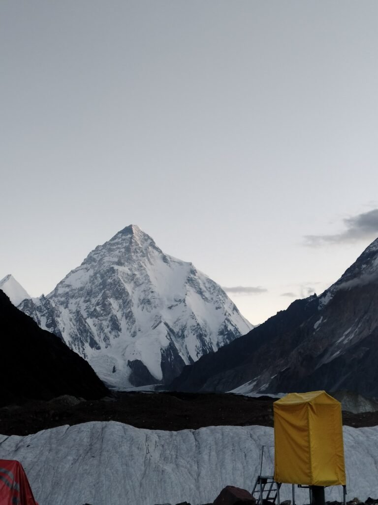
A K2 expedition is one of the most serious undertakings in mountaineering. The mountain stands 8,611 metres (28,251 feet) high, second only to Everest, and it is the highest peak in the Karakoram. The climb takes place on the Pakistan–China border, with the standard route on the Pakistani side in Gilgit-Baltistan, above the Godwin-Austen Glacier. People who search for a K2 expedition are usually trying to understand three things: how high and hard the mountain is, which route teams actually use, and when a summit attempt is realistic. The short answers are these. K2 is steeper and less forgiving than Everest, the usual line is the Abruzzi Spur, and the useful weather window is narrow, generally sought in July and August. The rest of this guide explains what that means on the ground. Height and location K2’s commonly given height is 8,611 metres. It lies in the Karakoram, not the Nepal Himalaya, and it is also known as Mount Godwin-Austen, after an early surveyor. The label K2 itself comes from the Great Trigonometrical Survey, which numbered prominent Karakoram peaks. The mountain later acquired another name, the Savage Mountain, after George Bell of the 1953 American expedition described it as a peak that tries to kill you. The phrase has lasted because the climbing remains objectively dangerous even in a modern, well-supported season. From the south, the peak rises above the Baltoro and Godwin-Austen glaciers. Base camp on a standard Pakistani-side expedition is typically placed around 5,150 metres, after the long walk from Askole through Concordia, where K2 finally appears in full beside Broad Peak and the Gasherbrums. The Abruzzi Spur, the standard route Most K2 expeditions climb the Abruzzi Spur, the mountain’s southeast ridge. The line was reconnoitred in 1909 by the expedition of Prince Luigi Amedeo, Duke of the Abruzzi, which reached around 6,250 metres and identified the ridge as the most practical way up. The spur itself is usually considered to begin near 5,400 metres, where advanced base camp is often sited. Above that, the route is a mixture of rock ribs, snow and ice, and several well-known technical features. House’s Chimney and the Black Pyramid are the major steps on the lower and mid mountain. Higher still, just below 8,000 metres, comes the Bottleneck: a steep couloir beneath hanging seracs. That passage, and the traverse that follows, is where many of the mountain’s worst accidents have occurred, because climbers are exposed both to the difficulty of the terrain and to the risk of falling ice. Other routes exist, but they are not the normal line for a supported K2 expedition. If you are joining a logistics-supported team from the Pakistani side, you should expect to be on the Abruzzi Spur, or occasionally on a closely related variation on the same southeast face of the mountain. A short history of the climb The first ascent was made on 31 July 1954 by Achille Compagnoni and Lino Lacedelli, on an Italian expedition led by Ardito Desio. They reached the summit via the Abruzzi Spur. The expedition included Pakistani members and Hunza support, and it remains one of the landmark climbs of the 20th century. The first winter ascent came much later, on 16 January 2021, when a team of Nepali climbers reached the top — the last of the 8,000-metre peaks to be climbed in winter. Those dates are part of the mountain’s story, but they should not be read as a promise that the climb has become routine. K2 has always had fewer ascents than Everest, and for many years the number of people who died on the mountain was high relative to the number who summited. More climbers have reached the top in recent seasons, and that historical ratio has eased, but the Bottleneck, the weather, and the steepness of the route have not gone away. Season, experience and risk The usual season is summer, with most teams looking for a summit window in July or early August. The useful period of stable weather can be only a couple of weeks. That is why itineraries are long: after the Baltoro approach, climbers need weeks at base camp to acclimatize, fix or use the route, and wait. A typical full K2 expedition from arrival in Islamabad to departure is around seven weeks, including a climbing period of roughly a month. This is not a first 8,000-metre peak for most people. Teams should already have technical experience at high altitude, ideally including 7,000-metre climbs and, for many members, a previous 8,000-metre mountain such as Gasherbrum II or Broad Peak. Strong movement on steep snow and ice, comfort with fixed ropes, and the judgment to turn around are more important than enthusiasm alone. The Baltoro approach Almost every Pakistani-side expedition follows the same path. After Islamabad, climbers fly or drive to Skardu, then travel by jeep to Askole. The walk then leads up the Braldu and onto the Baltoro Glacier, through camps such as Paiju, Urdukas, Goro and Concordia, before the final stage up the Godwin-Austen Glacier to K2 Base Camp. Some teams later leave the mountain over Gondogoro La into the Hushe Valley; others retrace the Baltoro. Skardu Expedition, based in Skardu, provides the permits, liaison arrangements, transport, porters, kitchen staff and base-camp infrastructure that a K2 team needs before the climbing even begins. The walk-in is not a sightseeing extra. It is the first long test of the expedition, and it is where the team begins to move as a unit. How high is K2? K2 is 8,611 metres (28,251 feet) high. It is the second-highest mountain on Earth and the highest in the Karakoram. When is the best time for a K2 expedition? Summer is the season, and most summit attempts are made in July or early August, when the chance of a stable window is highest. The exact dates change from year to year. What experience do you need? You should already have technical high-altitude experience, generally including 7,000-metre peaks and preferably a previous 8,000-metre

Chat with us on WhatsApp
Scroll to Top