Hunza Peak is the elegant snow summit that stands directly above Karimabad, in the Hunza Valley of Gilgit-Baltistan, Pakistan. At 6,270 metres, it is lower than the 8,000-metre giants of the Baltoro, yet it is not a trekking peak. It is a technical alpine climb of granite, ice and mixed ground, set on the southwest ridge of the Ultar Sar massif, in the Batura Muztagh — the western end of the Karakoram.
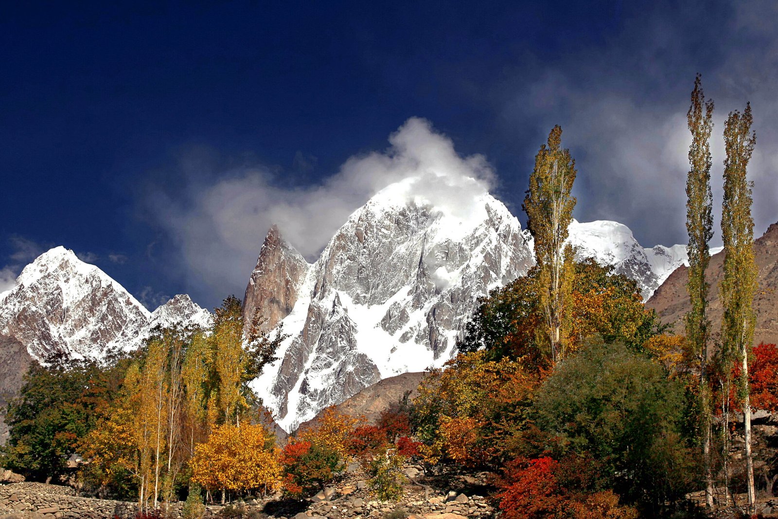
The mountain is famous in part because so many people have already seen it without knowing its name. From Baltit Fort, from the terraces of Karimabad, and from stretches of the Karakoram Highway, the same skyline appears: a slender rock needle, a snowier summit beside it, and a higher massif behind. The needle is Ladyfinger Peak. The snowier summit is Hunza Peak. The higher massif is Ultar Sar. Sorting out that view is the starting point for anyone searching the name.
Where is Hunza Peak?
Hunza Peak is located in the Hunza Valley, Gilgit-Baltistan, Pakistan, immediately above Karimabad. It belongs to the Batura Muztagh and sits on the southwest ridge of the Ultar Sar group, the most southeasterly of the major clusters in that subrange. The whole massif rises steeply from the valley floor, which is why the peak looks so close from the village and why the approach, by Karakoram standards, is unusually short.
That closeness is geographical, not logistical ease in the climbing sense. You can be in Karimabad one morning and walking up the Ultar gorge the next, but the ground above base camp is steep, exposed and technical. A Hunza Peak expedition is a compact alpine trip, not a long glacier walk followed by a moderate snow climb.
Height and the Ultar Sar skyline
Hunza Peak is 6,270 metres (20,570 feet) high. It has more than one snowy top of roughly similar height, a detail that matters mainly to climbers comparing historic lines, but the figure used throughout modern expedition descriptions is 6,270 metres. Ladyfinger Peak, also called Bublimotin, stands nearby at about 6,000 metres and has little prominence above the col it shares with Hunza Peak, which is why it looks so thin from below. Ultar Sar, the parent massif, rises to 7,388 metres.
From the valley, the three can blur into a single wall of rock and ice. Once you know the shapes, they separate cleanly: Ladyfinger is the sharp, relatively snow-free spire; Hunza Peak is the snow summit beside it; Ultar Sar is the larger mountain behind. This is also why photographs labelled “Hunza Peak” sometimes show the wrong summit. If you are planning a climb, it is worth being exact about which top you mean.
A short approach, a serious climb
Most teams reach Hunza by flying or driving from Islamabad to Gilgit, then continuing along the Karakoram Highway to Karimabad. From the village, the trek up the Ultar Nala to the pastures and on to base camp at around 4,000 metres usually takes one to two days. Compared with the week-long walk to the Baltoro 8,000ers, that approach is brief. It can also be steep, hot in the gorge, and exposed to objective hazard as you near the glacier.
The climbing itself is the main event. Routes involve couloirs, granite and mixed ground, and sharp snow or ice ridges, with grades in the serious alpine range rather than a simple snow plod. This is a peak for climbers who already move well on rock and ice at altitude, not for trekkers who want a high viewpoint. The short walk-in simply means more of the trip is spent on the mountain rather than on the approach.
First ascent and the character of the mountain
Hunza Peak was first climbed in 1991. The best-known of those early ascents is the alpine-style climb of the southwest ridge by Mick Fowler and Caradog Jones, who reached the col between Hunza Peak and Bublimotin from the Hasanabad side and then followed the ridge to the top. A later ascent in 2009 climbed toward the col from the east and joined the southwest ridge below the summit. The mountain has seen only a small number of ascents compared with more popular 6,000-metre objectives, which is part of its character: it is visible to everyone in the valley and climbed by relatively few.
Hunza Peak, Ladyfinger or Ultar Sar?
If your interest is a photograph from Karimabad or a walk to a viewpoint such as Duikar, you do not need to climb any of these peaks. The skyline is the attraction, and it is available from the valley. If your interest is a technical climb on the same ridge, you need to choose the objective carefully. Ladyfinger Peak is a sharp rock spire and a high-altitude big-wall problem. Ultar Sar is a much higher and more complex mountain. Hunza Peak sits between them in height and, for many alpine teams, in ambition: a serious 6,270-metre climb with a short approach and a memorable position above a living cultural landscape.
A supported Hunza Peak expedition is built around that choice: time in Karimabad, a short trek to base camp, and a climbing period long enough to fix the route, acclimatize and wait for a safe weather window.
Planning a trip to the Hunza Valley
The usual climbing season is summer, typically June to August, when conditions on the rock and ice are most workable. Mountain flights between Islamabad and Gilgit are weather-dependent, so any sound itinerary includes an overland option on the Karakoram Highway, with overnight stops if needed. Skardu Expedition can arrange transport, staff, base-camp support and current advice on paperwork. Hunza Peak lies below 6,500 metres and has often been treated as an open-area objective, but regulations can change, and teams should confirm the latest requirements before travel.
Frequently asked questions
How high is Hunza Peak?
Hunza Peak is 6,270 metres (20,570 feet) high. It is the snowier summit beside Ladyfinger Peak, on the southwest ridge of the Ultar Sar massif.
Where is Hunza Peak located?
It is located in the Hunza Valley of Gilgit-Baltistan, Pakistan, directly above Karimabad, in the Batura Muztagh of the Karakoram.
Is Hunza Peak the same as Ladyfinger Peak?
No. They are neighbouring summits on the same ridge. Ladyfinger Peak (Bublimotin) is the slender rock spire, about 6,000 metres high. Hunza Peak is the higher, snowier top at 6,270 metres.
How long is the approach?
From Karimabad, the walk to base camp generally takes one to two days up the Ultar gorge — a short approach by Karakoram standards, but followed by technical climbing, not a trek to the summit.