Lady Finger Peak is located in the Hunza Valley of Gilgit-Baltistan, Pakistan. Also called Ladyfinger Peak, Bublimotin or Bublimating, it is a sharp granite spire on the southwest ridge of the Ultar Sar massif, in the Batura Muztagh of the Karakoram. The tower rises directly above Karimabad, close enough that you can see it from the village, from Baltit Fort, and from viewpoints along the valley.
That is the straightforward answer most people are looking for. The rest of this article explains the local names, the height, the neighbouring peaks on the same skyline, and the difference between visiting Hunza to see the mountain and coming to climb it.
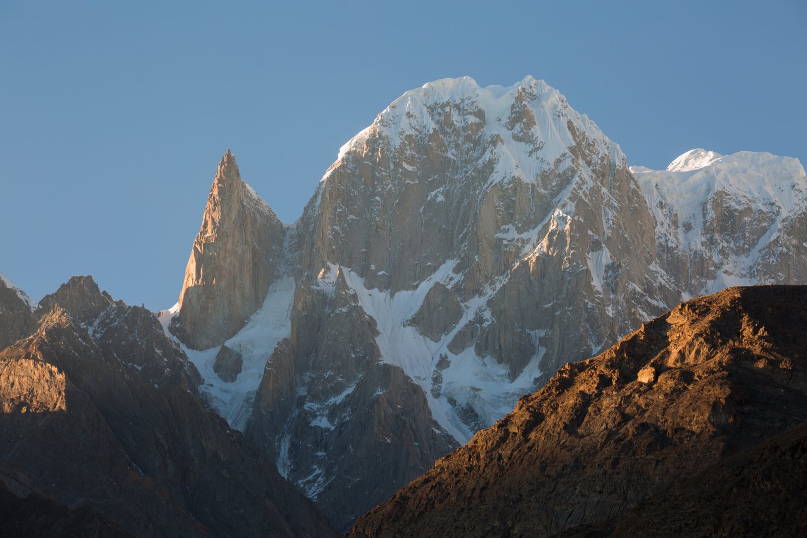
Lady Finger Peak is located in Hunza Valley, Pakistan
If you type “Lady Finger Peak is located in” into a search, the place you want is Hunza, in the north of Pakistan, in the region of Gilgit-Baltistan. The mountain stands above Karimabad, the historic heart of the valley, on the steep wall of peaks that includes Hunza Peak and Ultar Sar. It is not in Skardu, not on the Baltoro Glacier, and not in the same immediate neighbourhood as K2. It belongs to the western Karakoram, above a settled valley of terraces, orchards and forts.
Because the peak is so visible, it has become one of the signature shapes of Hunza. Travellers photograph it at sunset, when the granite takes on a warm colour, and often assume it is higher than it is, or confuse it with the snowier summit beside it. The location is simple; the skyline takes a little longer to read.
Local names and the view from Karimabad
The English name Ladyfinger, or Lady Finger Peak, describes the slender, almost finger-like profile of the spire. Locally and in climbing literature the mountain is also known as Bublimotin, Bubli Motin or Bublimating. All of these names refer to the same tower. You do not need to be a climber to see it. From Karimabad, from Baltit Fort, and from higher viewpoints such as Duikar (Eagle’s Nest), the spire stands out because it is relatively snow-free compared with the peaks around it.
The best-known companion on that view is Hunza Peak, the 6,270-metre snow summit immediately beside the needle. Behind them rises Ultar Sar at 7,388 metres. Once you can separate those three shapes, the photograph in front of you becomes easier to name, and you are less likely to plan the wrong climb.
How high is Ladyfinger Peak?
Ladyfinger Peak is about 6,000 metres high (19,685 feet). Some surveys list the summit at 5,993 metres. Either way, it is a 6,000-metre-class rock spire, not an 8,000-metre expedition peak. What makes it striking is not raw height but shape. The tower has little prominence above the col it shares with Hunza Peak, so from the valley it looks like a thin blade rather than a bulky mountain. That is also why a short approach from Karimabad should not be mistaken for an easy summit.
First ascent and the nature of the climb
The peak was first climbed on 22 May 1982 by a French team that included Patrick Cordier and Jacques Maurin. The ascent, and the routes repeated since, are serious high-altitude rock climbs, not ridge walks from the meadow. A modern Ladyfinger Peak expedition is a technical objective: steep granite, a glacier or couloir approach, and, on some lines, the gear and patience of big-wall climbing, including haul bags and living on the face.
This is worth stating plainly because the search that brings people here is often informational — they want to know where the mountain is — while the expedition page is for a much smaller group of experienced alpine and big-wall climbers. Both uses of the name are legitimate. They should not be mixed up.
Visiting Hunza versus climbing the peak
If you want to see where Lady Finger Peak is located, you travel to Hunza. The mountain is part of the everyday view from Karimabad, and a visit to Baltit Fort or a sunset at a valley viewpoint is enough to find it. No climbing permit and no technical skill are required to look at the spire, photograph it, or walk the village paths beneath it.
If you want to climb it, the approach is still short — typically a day’s steep walk from Karimabad up the Ultar gorge to Ultar Meadow — but the wall above camp is another matter. The route is reserved for experienced teams who already climb steep rock and mixed ground at altitude. A supported trip with Skardu Expedition is built around that reality: time in Karimabad, a brief approach, and a long enough climbing period to work the wall in good conditions, usually between June and August.
The mountain has often been treated as an open-area objective below the height at which special expedition permits are required, but rules can change. Anyone coming to climb, rather than to visit the valley, should confirm the latest paperwork before travel.
Ladyfinger Peak and Hunza Peak
The two summits share a ridge and a base-camp area, and they are often mentioned together. They are not the same climb. Hunza Peak is the higher, snowier mountain and a technical alpine route of rock, ice and mixed ground. Ladyfinger is the slender rock spire. If you are choosing an objective, start with the shape you can see from the valley, then read the route, not only the shared location. More detail on a climbing trip is on the Ladyfinger Peak (Bublimotin) expedition page.
Frequently asked questions
Where is Lady Finger Peak located?
Lady Finger Peak is located in the Hunza Valley, Gilgit-Baltistan, Pakistan, directly above Karimabad. It stands on the southwest ridge of the Ultar Sar massif in the Batura Muztagh of the Karakoram.
What is the local name of Lady Finger Peak?
It is also known as Bublimotin, Bubli Motin or Bublimating. These names all refer to the same granite spire.
How high is Ladyfinger Peak?
The peak is about 6,000 metres high. Some surveys give 5,993 metres. Neighbouring Hunza Peak is higher, at 6,270 metres.
Can you hike to the summit?
No. You can hike to viewpoints in the Hunza Valley and, with a proper trek, to Ultar Meadow beneath the wall. The summit itself is a technical rock climb for experienced alpine teams, not a hiking route.